- Home
- Canal Walking [ Walking in Fushimi ]
Here are some popular sightseeing spots
in Fushimi.
Compare the old images with the original spots,
and enjoy walking!
Remains of Municipal Electric Railway Inari Station
The last station is on the bridge over the canal
Fushimi Incline Upper Dam and Sumizome Power Plant
Active power plant known as a beautiful spot with cherry blossoms
Fushimi Incline Lower Dam / Fushimi New Discharge Channel
Discharge channel established after catastrophic flood damages
Recommended Route
Here are some recommended
walking routes!
Long Walking Route
- Approx. 1 hour 45 minutes
- Approx. 2 hours 10 minutes (excluding breaks)
- ①Shichijo Station on Keihan Line
- 5 minutes on foot
- ②Shiokoji Bridge
-
30 minutes on foot From Shiokoji-dori, go south along the left bank of the canal, and head down to Hommachi-dori

- ③Hexagram Symbol (Yokonawa Bridge)
-
4 minutes on foot Visiting Fushimi Inari Taisha is also recommended, if you have time

- ④Remains of municipal electric railway Inari Station
- 15 minutes on foot
- ⑤Pentagonal star symbol (Shidan Bridge)
-
25 minutes on foot You can enjoy beautiful cherry blossoms around the Sumizome Dam area.

- ⑥Fushimi Incline Upper Dam/Sumizome Power Plant
-
5 minutes on foot The bus stop is in front of the Fushimi Tax Office

- ⑦City Bus Stop "Fushimi Incline-mae"
- 2 minutes on foot
- ⑧Remains of Fushimi Incline
-
5 minutes on foot Cross the footbridge over Route 24, and go south

- ⑨Fushimi Incline Lower Dam
-
1 minute on foot The canal flows through the quiet residential area

- ⑩Fushimi New Discharge Channel
- 5 minutes on foot
- ⑪Imonoya Bridge
- 9 minutes on foot
- ⑫Fushimi Station on Kintetsu Kyoto Line
Short Walking Route
- Approx. 35 minutes
- Approx. 50 minutes (excluding breaks)
- ①Sumizome Station on the Keihan Main Line
- 5 minutes on foot
- ②Fushimi Incline Upper Dam/Sumizome Power Plant
-
5 minutes on foot The bus stop is in front of the Fushimi Tax Office

- ③City Bus Stop "Incline-mae"
- 2 minutes on foot
- ④Remains of Fushimi Incline
-
5 minutes on foot Cross the footbridge over Route 24, and go south

- ⑤Fushimi Incline Lower Dam
-
1 minute on foot The canal flows through the quiet residential area

- ⑥Fushimi New Discharge Channel
- 5 minutes on foot
- ⑦Imonoya Bridge
- 9 minutes on foot
- ⑧Fushimi Station on the Kintetsu Kyoto Line

-
Shiokoji Bridge
The Kamo River Canal starting from the intersection between Reisen-dori and Kawabata-dori drains into Sanjo-dori, and its flow re-appears from Shiokoji Bridge. It was changed to be drained in 1988 (Showa 63) in connection with the undergrounding of Keihan Electric Railway. In order to maintain canal function, there are still towing ropes attached on the west side in the underground drain.
-
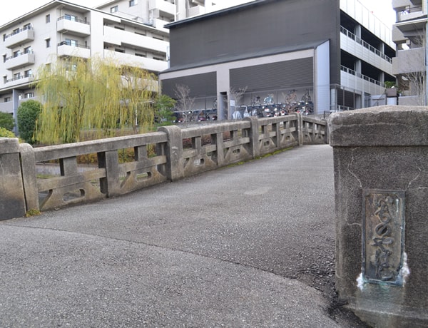
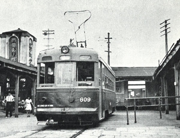
Remains of Municipal Electric Railway Inari Station
Do you know that there was a "station" over the canal in the past? The municipal electric railway shuttled between Kyoto Station and Fushimi Inari until the 40s in the Showa Era, and Inari Station at the end of the line was on Inari Bridge over the canal. It became a park, and there is nothing left of the old station. A flash of the rail on the edge, however, clearly indicates the municipal railway was once alive and running.

-
Crests on bridge piers
Some bridges over the Kamo River Canal have the star-shaped crests on their piers. There are two types of crests: one is the hexagonal star used for Kyoto City Water Supply Projects including the electric power project, which remains on several bridges. The other is the pentagonal star used by the army, which remains on the Shidan Bridge along with traces of the Army's 16th Division placed in Fukakusa until the end of the War.
1914 (Taisho 3rd year)
-
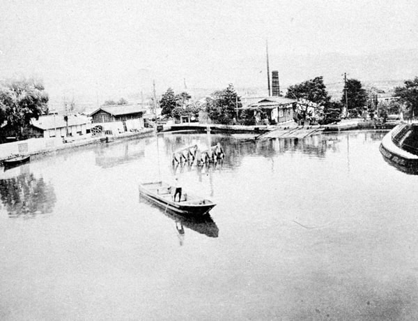
Fushimi Incline Upper Dam and Sumizome Power Plant
Since ships passing through the Incline needed places to wait, a dam was installed on upper and lower positions of the Incline. There are cherry trees that were planted for the purpose of the retaining wall in the upper dam, and they still bloom magnificent blossoms every spring. Also, in order to generate electric power, the Fushimi Power Plant (current Sumizome Power Plant) was constructed in 1914 (Taisho 3rd year), and it still operates as an active facility.
1914 (Taisho 3rd year)
-
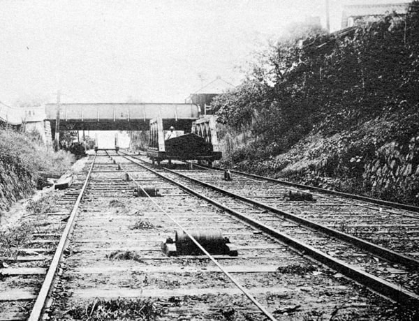
Remains of Fushimi Incline
The Fushimi Incline, completed in 1895 (Meiji 28), was driven by a waterwheel, which was different from the Keage Incline, which used motorized power. As many as 100 boats a day were raised and lowered in those days, but general operation was brought to a stop in 1943 (Showa 18), and the rails were removed in 1960 (Showa 35). Today only its name remains at the city bus stop.
-
Fushimi Incline Lower Dam / Fushimi New Discharge Channel
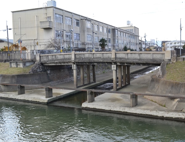
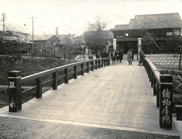
The Fushimi Incline was approximately 290 meters long, and it took about five minutes to travel in both directions. There remains a part of the brick structure at the canal outlet in the lower dam. In addition, the downstream Fushimi New Discharge Channel was completed in 1925 (Taisho 14) after catastrophic flood of the Yodo River, and it has an elaborate design engraved with the crest of Kyoto City (abbreviation) on the bridge.
1927 (Showa 2nd)
-
Imonoya Bridge
This is the end of Lake Biwa Canal, and the first canal, flowing from Okazaki and named Oto Canal, as well as that from Kamo River Ebisugawa Deai, named Kamo River Canal, changes its name again to Hori River at this point and connects to Uji River via the Misu Lock Gate. Note that there also remains a part of brick used in those days on the left bank of this bridge.

